Understanding Bali rainy season and typhoon risks
Bali Villa Hub
3/19/2026
Understanding Bali rainy season and typhoon risks
Visiting Bali during the wet season raises common questions about timing, storm risk and how weather affects travel plans. This guide clarifies what to expect, where risks concentrate, and practical steps to stay safe and flexible so you can still enjoy the island’s green landscapes and quieter attractions.
Defining Bali rainy season and typhoon likelihood
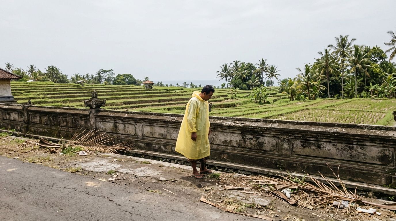
Bali's rainy season typically runs from November to April, with the wettest months clustered between December and February. During this period the island experiences higher humidity and frequent convective showers that are most likely in the late afternoon and overnight. Sea conditions often become choppier, which can reduce visibility for diving and make small boat travel less reliable.
Direct tropical cyclone strikes on Bali are extremely rare because the island lies well south of the northwest Pacific typhoon belt. More common are heavy rainfall events tied to monsoon patterns or to weakened storm systems that have lost cyclone strength before reaching the island. Even diminished systems can produce intense downpours and strong gusts that last one to three days.
The primary hazards during the wet season are short, intense downpours that can trigger flash flooding in low-lying coastal plains and river mouths, and an increased landslide risk in the central highlands after prolonged rain. Urban drainage can be overwhelmed in parts of Denpasar and the southern peninsula, causing street flooding. Rough seas and increased surf also raise the chance of ferry cancellations and unsafe conditions for small craft along west- and south-facing coasts.
For practical planning, accept that wet afternoons are likely and build flexibility into itineraries: choose lodgings with good drainage and allow extra travel time when moving between regions. With sensible precautions and up-to-date weather information the rainy season remains a viable time to visit and often rewards travellers with lush scenery, fewer crowds and attractive pricing.
With these general risks in mind, it helps to look next at exact timing and how often storms occur so you can plan travel windows appropriately.
When the wet season runs and how often storms occur
Bali's wet season runs from November through April, with the greatest rainfall concentrated in December, January and February. Rain typically falls in heavy bursts rather than steady drizzle, so a single day can hold a mix of bright sun, wet afternoons and nighttime downpours.
Typical season timeline
November marks the transition into wetter weather as humidity rises and showers become more frequent. December, January and February are the peak months when average monthly rainfall is highest and the number of rainy days can reach the mid to high teens. March eases gradually while April continues the drier trend toward the dry season. Showers are most common in the late afternoon and overnight, though morning storms do occur.
Storm frequency and severity
Short, intense convective storms occur regularly during the peak months—often several times each week in many areas. These storms can produce heavy rain for 30 minutes to a few hours and cause localised flash flooding on slopes and in low-lying streets. More extensive storm systems that disrupt ferry schedules and cause multi-day travel delays appear less often, roughly once every two to four weeks during the wettest period. Direct tropical cyclone strikes on Bali are effectively negligible, so the main concerns are intense rainfall, strong gusts and rough seas.
Practical timing to monitor weather
Check forecasts at least 48 to 72 hours before key travel or boat trips and again on the morning of departure. Localised warnings and advisories are especially useful for coastal crossings and mountain roads. With sensible scheduling most travellers find they can enjoy dry windows between storms and still make the most of the island.
Understanding when storms are likeliest leads naturally into regional rainfall patterns and where flood risk is greatest.
Rainfall patterns and flood risk by month and region
Bali sees its heaviest rain from December through February, with November and March as transition months and April marking a steady decline. Rain typically arrives in intense afternoon or overnight bursts rather than light steady precipitation, so monthly totals can be concentrated in a small number of extreme events.
Flood risk varies significantly by area because of terrain and drainage. Coastal plains and urban centres with limited drainage experience fast surface flooding, while steep central slopes are prone to prolonged runoff and landslides after multiple wet days.
- Southern coast and Denpasar/Badung — Heavy downpours can produce urban street flooding and clogged drains, with monthly rainfall often between 200 and 350 millimetres at the peak.
- Central highlands (Ubud and Bedugul) — Higher elevation means longer lasting rain and runoff, with peak month totals regularly exceeding 400 millimetres and an elevated landslide risk where slopes are unstable.
- West coast and Tabanan — This region can see some of the island's most intense storms in peak months, producing rapid river rises and localized coastal flooding near river mouths.
- East Bali and the Nusa islands — These areas are generally drier but still see strong convective storms; monthly totals are often 100 to 250 millimetres with flood risk concentrated around small river basins.
- Seasonal timing by month — December, January and February are the highest risk for multi-day disruption while November and March need caution as storms become more frequent and unpredictable.
When planning travel, check short-term forecasts and avoid low-lying river crossings after heavy rain. Choosing accommodation above flood plains and allowing flexible transfers reduces disruption and keeps itineraries realistic.
With regional risk in mind, the next section outlines travel safety and transport tips to reduce exposure during heavy rain and storms.
Travel safety and transport tips during heavy rain and storms
Heavy rain in Bali can change travel plans quickly, so prepare with practical steps that reduce risk and keep your itinerary flexible. Focus on timely weather checks, good communication with your host and conservative transport choices when conditions deteriorate.
Plan ahead and monitor conditions
Check forecasts at least 48 to 72 hours before key transfers and again the morning of departure. Ask your accommodation about local road conditions and known flood points, and register expected arrival times so someone knows if you are delayed. Allow extra travel time for every transfer and prefer daytime movement when storms tend to be less frequent.
Road and scooter safety
Riding a scooter in heavy rain increases crash risk because road markings vanish and surfaces become slippery. If visibility is poor, find a safe shelter and wait until rain eases. Avoid crossing flowing water where depth looks greater than 30 centimetres and do not attempt steep downhill runs after prolonged rain. Keep helmet visor closed, use a waterproof bag for documents and slow to under 40 km/h (kilometres per hour) while keeping a wide margin to the vehicle ahead.
Boat travel and coastal transfers
Small boats and local crossings are the first services to be suspended when seas turn rough. Confirm sailings 24 to 48 hours in advance and again before boarding. If advisories warn of strong winds, choose larger scheduled ferries or postpone crossings rather than risk improvised landings at exposed beaches. Expect cancellations and keep alternatives ready.
Practical caution and clear communication with drivers, operators and your host will usually keep disruption minimal. Prioritise safe travel over rigid schedules and you can still enjoy Bali even when storms appear.
Next, consider where to base yourself and which activities work best when storms hit.
Best areas to stay and activities when storms hit
When storms arrive, choose a base that reduces travel risk and offers comfortable indoor options. Look for properties with good drainage, reliable staff and easy road access to main routes. Picking the right neighbourhood keeps transfers short and makes it simple to switch plans if a heavy downpour appears.
How to pick the safest neighbourhood
Prioritise elevation and infrastructure over beachfront glamour during the wettest months. Areas with well-maintained roads, organised drainage and immediate access to shops and clinics will limit disruption. A villa with covered outdoor space and an indoor living area gives the best balance between fresh air and shelter when rain is persistent.
- Ubud (central highlands) — Offers less risk from coastal surge and easy access to indoor activities such as spa treatments, yoga classes and cooking workshops. Expect longer lasting showers but fewer sudden street floods.
- Sanur and east coast villages — These locations are often more sheltered from strong south-west winds and have calmer seas on most stormy days, making short coastal walks and beachfront cafes practical between showers.
- Nusa Dua and the southern resort corridor — Choose areas with solid drainage and guarded access to main roads. Villas here typically offer on-site dining, private pools and covered terraces that keep guests comfortable during multi-hour storms.
- Higher ground near Denpasar — Staying above flood plains near the city lets you reach medical services, shops and transport quickly while avoiding low-lying street flooding during heavier events.
Plan activities that tolerate pauses and sudden rain. Book indoor highlights on forecast wet days and reserve open-air excursions for forecasted dry windows to make the most of both weather conditions and downtime.
If you want flexible villa options that simplify last-minute changes, consider comparing properties and cancellation terms at https://www.balivillahub.com/en to find a suitable base for wet-season travel.
Packing, planning and pros and cons of visiting in the wet season
Packing well makes the wet season feel manageable and comfortable. Bring a compact waterproof jacket with taped seams and a hood, two quick-dry shirts and one pair of quick-dry trousers. Include closed trainers with good grip and rubber-sole sandals for shallow water and muddy paths. Pack a 5 litre dry bag for electronics and documents, a waterproof phone pouch and a few silica gel packets to protect cameras. Add a small medical kit with oral rehydration sachets, antihistamine and antiseptic; insect repellent containing DEET (N,N-Diethyl-meta-toluamide); and reef-safe sunscreen. For scooter riders carry a visible rain poncho and a full-face helmet visor insert. Prepare luggage by placing important papers in a zip-lock and taking photos of documents on your phone. In planning, allow at least one extra hour per road transfer, check forecasts 48 to 72 hours ahead of boat crossings and avoid river fords after heavy rain when depth is uncertain.
There are clear pros and cons to travelling in the wet season. Pros include far fewer tourists, easier restaurant reservations and private villa availability, lush green scenery for photography and lower hotel rates. Cons include frequent short intense downpours, higher humidity and an increased chance of ferry cancellations or single-day road closures from localised flooding. Landslide risk rises in steep central areas after several rainy days, so choose lower-risk zones for overnight stays. Mitigate downsides by scheduling indoor activities on forecast wet days, booking transfers with reputable drivers and carrying travel insurance that covers weather-related changes. With sensible packing and flexible plans many travellers find the rewards of quieter beaches, vibrant landscapes and better value outweigh the inconveniences.